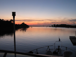
River sunsets are a nightly reward.

Grand kids play at Port Charles Harbor on river bank.

Children play on beach and in the water on Anchor Yanker Island . House boats tied up in backround.

A favorite is doing the "Float" To do the float one must wear a life vest then get into the water at the up river end of the island and let the water carry you to the down river end. This process is often repeated many times.
alton

Alton pool (lake) and bluffs

Passing the Arch "Gateway to the West".

Grafton Ill.

Loading dock (great river resturant stop) in the town of Grafton Ill. Also location of Grafton Marina. Durring World War II the red roofed building was where "PT boats" were manufactured.

Port Charles Harbor is where we keep "Great Escape" on dock 6. come see us! We are AGLCA "harbor hosts". I know I'm predjudiced but I think we have the friendliest marina anywhere. A full fillup with fuel can usually get a transient boater a free night at the dock as well as a home cooked meal if we are cooking on the dock. When we're not doing a dock meal the transient boaters are welcome to dine at the exclusive, private "Duck Club Marina" adjoining our marina's parking lot. This, along with the highest quality repair work and a 60 ton travel lift with a loaner car when needed makes for a great stay. And a visit to the old riverfrount town of St. Charles Mo. (1st capitol of our state) is a shoppers paradise!

Port Charles picnic area

Enjoying friends

Swimming pool at Grafton Marina located at the town of Grafton.

Duck Club Marina next to Port Charles Harbor.

Wonderful place to anchor on the trip south is the "Little River Diversion Channel" just South of Cape Giradeau Mo.

The anchorage is deep and away from the wakes on the river thru the night from passing tow boats.

Port Charles Harbor Marina

Alton Marina is a great place to stay just above the Alton lock with a shuttle to the gambling boat to relieve you of your money. ( see previous post on our Alton Marina trip with the grandkids.)

Hoppie's Marina in Kimswick Mo at mile 152 is THE OLDEST MARINA WEST OF THE MISSISSIPPI R.. No trip would be complete without experiencing the commorodory on their dock and visiting the old French fur trading settlement and dining at the Blue Owl for their famous pies!
Its been said that the Mississippt River is the worst part of doing the "Great Circle" route by "Skipper Bob". He was the accepted authority on the "Loop" route until he passed on. I don't like to dispute someone who is the expert; but to us "River Rats" and Mark Twain, the "ole Mississippi" is and was a great place to boat. Here you have seen few pics of our beautiful scenery, sandy beaches, and wonderful transient friendly marinas.
 River sunsets are a nightly reward.
 Grand kids play at Port Charles Harbor on river bank.
 Children play on beach and in the water on Anchor Yanker Island . House boats tied up in backround.
 A favorite is doing the "Float" To do the float one must wear a life vest then get into the water at the up river end of the island and let the water carry you to the down river end. This process is often repeated many times.
 Alton pool (lake) and bluffs
 Passing the Arch "Gateway to the West".
 Grafton Ill.
 Loading dock (great river resturant stop) in the town of Grafton Ill. Also location of Grafton Marina. Durring World War II the red roofed building was where "PT boats" were manufactured.
 Port Charles Harbor is where we keep "Great Escape" on dock 6. come see us! We are AGLCA "harbor hosts". I know I'm predjudiced but I think we have the friendliest marina anywhere. A full fillup with fuel can usually get a transient boater a free night at the dock as well as a home cooked meal if we are cooking on the dock. When we're not doing a dock meal the transient boaters are welcome to dine at the exclusive, private "Duck Club Marina" adjoining our marina's parking lot. This, along with the highest quality repair work and a 60 ton travel lift with a loaner car when needed makes for a great stay. And a visit to the old riverfrount town of St. Charles Mo. (1st capitol of our state) is a shoppers paradise!
 Enjoying friends
 Swimming pool at Grafton Marina located at the town of Grafton.
 Duck Club Marina next to Port Charles Harbor.
 Wonderful place to anchor on the trip south is the "Little River Diversion Channel" just South of Cape Giradeau Mo.
 The anchorage is deep and away from the wakes on the river thru the night from passing tow boats.
 Port Charles Harbor Marina
  Alton Marina is a great place to stay just above the Alton lock with a shuttle to the gambling boat to relieve you of your money. ( see previous post on our Alton Marina trip with the grandkids.)
 Hoppie's Marina in Kimswick Mo at mile 152 is THE OLDEST MARINA WEST OF THE MISSISSIPPI R.. No trip would be complete without experiencing the commorodory on their dock and visiting the old French fur trading settlement and dining at the Blue Owl for their famous pies!


